Multiresolution Fusion (Pan-Sharpening)
TNTmips allows you to display, create, and process images of any type and up to terrabytes in size. You can enhance, combine, rectify, reproject, mosaic, and
classify your geospatial images to optimize information extraction and data presentation. In addition, the Display process provides inline spatial filtering, enhancement, and reprojection options that allow you to design the best views of your images. You can even work with hyperspectral images in the
Hyperspectral Analysis process.
See also:
Tech Guides on Image Processing and
Image Processing tutorials.


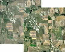
Locally Adaptive Contrast Enhancement

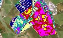
Classification restricted using mask
Image Processing Highlights
- Pipeline architecture provides fast and efficient image display and processing
- Use JP2, MrSID, and ECW images without import; multi-threaded JPEG2000 compression/decompression for efficient use of large compressed images
- Work with rasters with any data type from binary to floating-point and color composites
- Mosaic grayscale, multiband, or color images with mixed georeference to any map coordinate system
- Use simplified interactive Geoformula dialog to compute virtual display layers from one or more geodata layers
- Mosaic any number of images of any size directly to a tileset (a linked set of uniformly-sized files in GeoJP2, PNG, or GeoTIFF format) for fast efficient access
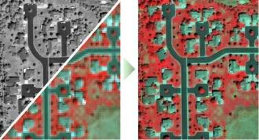
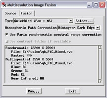
- Pan-sharpen multispectral satellite images with color calibration for Ikonos and QuickBird
- Rectify-reproject georeferenced images to any of hundreds of predefined coordinate reference systems or define your own
- Orthorectify ortho-ready QuickBird, Ikonos, and other satellite images
- Orthorectify airphotos via Georeference, Rational - Computed model
- Frequency filtering and wide selection of spatial filters
- Supervised and unsupervised classification of multispectral images
- Use Principal Components or interactive Progressive Transformation procedures for image analysis and data reduction
- Trend removal, decorrelation stretch, locally adaptive contrast enhancement, contrast matching, multilinear regression, and others
- Built-in geospatial scripting language for custom processing, hundreds of sample scripts
- Display process provides inline spatial filtering, contrast enhancement, color palettes, variable transparency, masking, and on-the-fly reprojection
