Raster & Image Processing
Technical Guides & other documentation
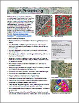
TNTmips allows you to display, create, and process images of any type and up to terrabytes in size. You can enhance, combine, rectify, reproject, mosaic, and classify your geospatial images to optimize information extraction and data presentation. In addition, the Display process provides inline spatial filtering, enhancement, and reprojection options that allow you to design the best views of your images.
RASTER & IMAGE PROCESSING
Raster & Image Processing

Raster & Image Processing
Raster & Image Processing
Raster & Image Processing
Raster & Image Processing
Raster & Image Processing
Raster & Image Processing
Raster & Image Processing
Raster & Image Processing
Raster & Image Processing
Raster & Image Processing
Raster & Image Processing
Raster & Image Processing
Raster & Image Processing
Raster & Image Processing
Raster & Image Processing
Raster & Image Processing
Raster & Image Processing
Raster & Image Processing
Raster & Image Processing
Raster & Image Processing
