Transform Map and Image Data for Use on the Web
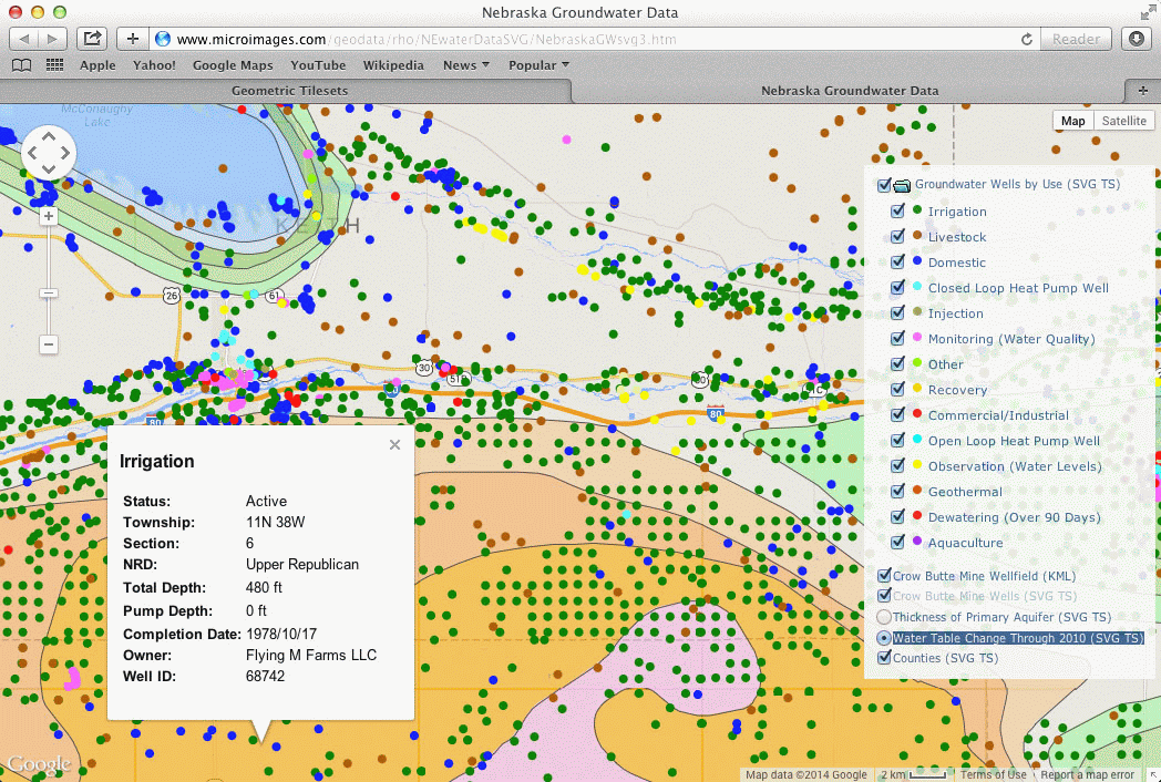
Use TNTmips to convert your imagery and map layers to web tilesets and create geomashups that display these layers on the Web in a browser using the Google Maps, Open Layers, and Google Earth mapping platforms. See the Publish Web Maps page for more information.
Geomashup Creation
Geomashup showing groundwater data for Nebraska, including a map of historic change in depth to the water table and locations of wells. Info windows in the browser reveal attribute data for the map elements in tilesets.
