LIDAR Point Profiles
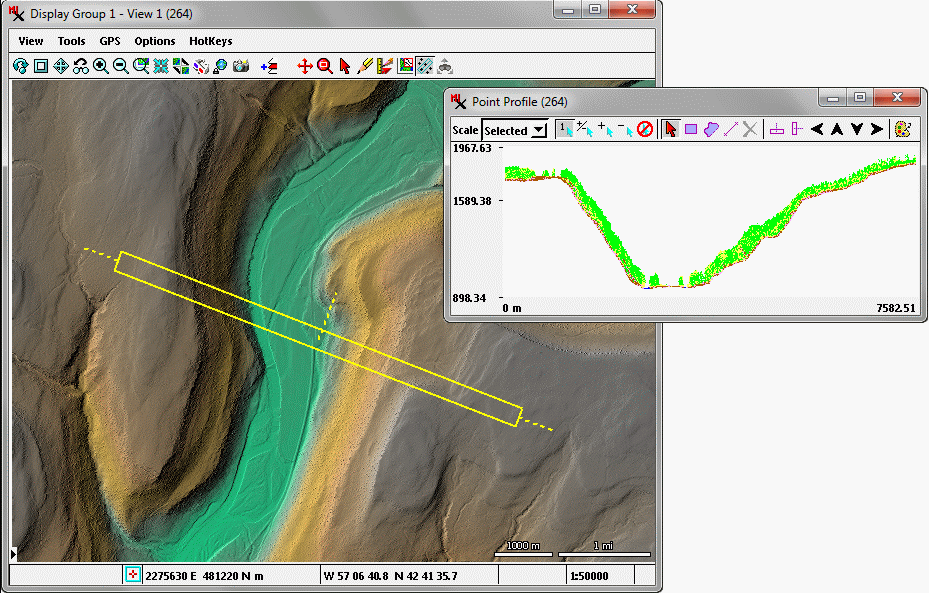
The Point Profile tools displays a vertical profile of 3D LIDAR points within a rectangular area you draw in the View window. Your choice of point classes to show in the profile can be different than those used in the View. See the Point Profile Tool Technical Guide for more information.
Point Profile Tools
LIDAR point profile using all point classes from the yellow rectangular area in a color relief-shaded virtual terrain display using only ground points.
